
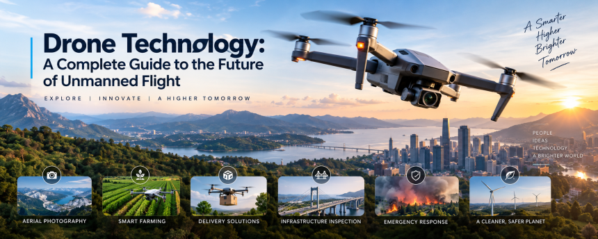
Drones have become one of the most exciting and rapidly developing technologies of the modern world. What once seemed like a futuristic invention from science-fiction movies is now part of everyday life. From capturing breathtaking aerial photographs to delivering medical supplies, inspecting buildings, helping farmers, and supporting emergency teams, unmanned aircraft are changing how people work and live.
But what exactly makes these flying machines so useful? How do they stay in the air, find their way, and perform complex tasks without a pilot sitting inside them?
The answer lies in a combination of advanced sensors, software, cameras, communication systems, and intelligent automation. As these technologies continue to improve, small aircraft are becoming more capable, affordable, and accessible.
This article explores how modern unmanned aerial systems work, where they are used, their benefits and limitations, and what the future may hold. Whether you are simply curious about these machines or interested in how they may affect society, this guide will help you understand the world of aerial robotics in simple language.
What Is Drone Technology?
At its simplest level, drone technology refers to the systems used to operate an unmanned aircraft. Unlike traditional airplanes or helicopters, these aircraft do not need a person sitting inside the cockpit. Instead, they can be controlled remotely or programmed to fly automatically.
Many people think of a small quadcopter with four propellers when they hear the word drone. While that is one of the most common designs, unmanned aircraft come in many different shapes and sizes.
Some are small enough to fit in the palm of your hand, while others are large enough to carry heavy equipment. Some use multiple propellers, while others look more like traditional airplanes with fixed wings.
The basic idea is simple: a machine flies without a human pilot physically onboard.
Most systems include several important parts:
- The aircraft itself
- Propellers or another flight system
- Batteries or another power source
- Sensors
- Cameras
- GPS positioning
- Communication equipment
- Flight-control software
- A remote controller or automated control system
Think of the aircraft as a flying computer. Just as a smartphone combines hardware and software to perform different tasks, an unmanned aircraft combines physical components with digital intelligence to navigate and complete missions.
How Do Drones Actually Work?
The ability to fly smoothly and remain stable depends on several technologies working together at the same time.
A typical multi-rotor aircraft uses spinning propellers to create lift. The motors can speed up or slow down individually, allowing the aircraft to move in different directions.
For example, changing the speed of specific motors can help the aircraft:
- Rise into the air
- Descend
- Move forward
- Move backward
- Turn left or right
- Remain in one position
The Role of Flight Controllers
The flight controller acts like the brain of the aircraft. It constantly receives information from different sensors and makes extremely fast adjustments.
Without this system, keeping a small aircraft stable would be much more difficult.
Imagine trying to balance a pencil vertically on the tip of your finger. You would need to make constant, tiny movements to stop it from falling. A flight controller performs a similar task thousands of times by monitoring movement and adjusting the motors.
Sensors and Navigation Systems
Modern aerial systems use several sensors to understand their surroundings and position.
These may include:
- GPS receivers
- Gyroscopes
- Accelerometers
- Altitude sensors
- Cameras
- Infrared sensors
- Ultrasonic sensors
GPS helps the aircraft understand its approximate location, while gyroscopes and accelerometers help measure movement and orientation.
Some advanced models can also recognize obstacles. This allows them to avoid trees, walls, buildings, and other objects during flight.
The combination of these systems makes autonomous flight possible.
Different Types of Drones
Not all flying robots are designed for the same purpose. Different designs are tailored to perform specific tasks more effectively.
Multi-Rotor Drones
Multi-rotor models are among the most popular consumer and professional options.
They usually have four, six, or eight propellers. A four-propeller design is often called a quadcopter.
These aircraft are especially useful because they can:
- Take off vertically
- Hover in one place
- Move in multiple directions
- Land in small areas
They are commonly used for photography, videography, inspections, and recreational flying.
However, their flight time is often limited because they use significant energy to remain airborne.
Fixed-Wing Drones
Fixed-wing aircraft look more like traditional airplanes.
Instead of hovering with multiple propellers, they use wings to generate lift while moving forward.
This design makes them more energy-efficient over long distances.
They are often used for:
- Land surveys
- Mapping
- Agricultural monitoring
- Environmental research
- Large-area inspections
The main limitation is that many fixed-wing models cannot hover and may require more space for takeoff and landing.
Hybrid Designs
Hybrid aircraft combine features from both fixed-wing and multi-rotor designs.
They may take off vertically like a helicopter and then transition into forward flight like an airplane.
This approach can offer longer flight distances while maintaining flexible takeoff capabilities.
As technology develops, hybrid systems may become increasingly common in commercial operations.
The Growing Role of Artificial Intelligence
Artificial intelligence is becoming increasingly important in aerial robotics.
Traditional systems follow instructions given by a human operator or pre-programmed flight route. AI can make these systems more intelligent by helping them analyze information and respond to changing conditions.
For example, an intelligent aircraft may be able to recognize:
- Vehicles
- Buildings
- Roads
- Crops
- Animals
- People
- Obstacles
This capability can be extremely useful for industries that need to analyze large areas quickly.
Computer Vision
Computer vision allows machines to interpret visual information captured by cameras.
Aerial cameras can collect enormous amounts of images and video. AI software can then analyze this information faster than a person could manually review every frame.
For example, a system used in agriculture might identify areas where crops appear unhealthy.
An inspection aircraft might detect visible damage on a structure.
A search-and-rescue team might use intelligent software to help identify objects or people in a large area.
In this way, the flying machine is not simply collecting information. It is becoming part of a larger intelligent system.
Drones in Photography and Filmmaking
One of the most visible uses of aerial technology is photography and videography.
In the past, capturing aerial footage often required helicopters, expensive equipment, or specialized crews.
Today, a relatively small aircraft can capture dramatic views from the sky.
This has changed industries such as:
- Film production
- Travel content
- Real estate
- Weddings
- Sports coverage
- Tourism
- Social media
A New Perspective
Aerial cameras give creators a perspective that was once difficult and expensive to achieve.
Imagine watching a football field from the ground and then seeing it from hundreds of feet above. The entire scene suddenly looks different.
That is the power of aerial imagery.
Modern camera systems can capture high-resolution photographs and smooth video while using stabilization technology to reduce unwanted movement.
This has allowed filmmakers and content creators to experiment with creative angles that were once available only to large production companies.
Agriculture and Smart Farming
Agriculture is another area where aerial systems are creating major changes.
Farmers often manage large areas of land, making it difficult to inspect every section manually.
Flying sensors and cameras can help monitor fields more efficiently.
Monitoring Crop Health
Special cameras can detect information that is not always obvious to the human eye.
They can help identify possible differences in plant health, water levels, or growth patterns.
This information may help farmers understand:
- Which areas need more attention
- Where irrigation may be required
- Whether crops appear stressed
- How plants are developing
- Which sections of a field need inspection
Instead of treating an entire field exactly the same way, farmers may be able to make more targeted decisions.
This approach can potentially save time, reduce waste, and improve productivity.
Precision Agriculture
Precision agriculture uses technology to manage farming activities more accurately.
Aerial data can work alongside other tools, such as ground sensors and satellite information.
Together, these systems can create detailed maps of agricultural land.
It is similar to giving a farmer a bird’s-eye view combined with a digital report card for the field.
The farmer can then make decisions based on actual information rather than relying only on visual observation from the ground.
Delivery and Transportation
One of the most talked-about possibilities is aerial delivery.
The idea is simple: instead of transporting small packages entirely by road, certain items could be delivered through the air.
Potential applications include:
- Medical supplies
- Emergency equipment
- Small packages
- Food deliveries
- Laboratory samples
This could be especially valuable in remote locations or areas where road transportation is slow.
Medical Delivery
Healthcare may benefit significantly from this type of transportation.
In certain situations, medical supplies need to reach their destination quickly.
Small aircraft may help transport items such as medicines, samples, or emergency equipment when traditional transportation takes too long.
However, widespread aerial delivery still faces important challenges.
These include:
- Airspace regulations
- Safety requirements
- Weather conditions
- Battery limitations
- Privacy concerns
- Noise
- Public acceptance
For delivery systems to become common, companies and governments will need reliable rules and infrastructure.
Emergency Response and Search Operations
During emergencies, time is often the most important resource.
Aerial systems can provide emergency teams with a quick view of dangerous or difficult-to-reach areas.
They may be used during:
- Natural disasters
- Floods
- Wildfires
- Search operations
- Building collapses
- Missing-person cases
Providing a View from Above
Imagine trying to search a large forest for a missing person.
A team walking on the ground may need hours or days to cover the area.
An aircraft equipped with cameras and sensors can quickly provide a wider view.
Thermal imaging equipment may also help identify heat sources under certain conditions.
This does not replace trained emergency workers. Instead, it gives them another tool that can help them make faster and better-informed decisions.
Disaster Assessment
After an earthquake or flood, roads and buildings may become difficult or dangerous to access.
Aerial surveys can help authorities assess damage before sending teams into potentially hazardous areas.
Images and maps collected from above can help emergency organizations understand:
- Which roads are blocked
- Where buildings have been damaged
- Which areas are flooded
- Where assistance may be needed
This information can support faster planning and coordination.
Infrastructure Inspection and Maintenance
Many important structures are difficult to inspect manually.
Consider bridges, power lines, wind turbines, tall buildings, and communication towers.
Inspecting these structures can require workers to climb dangerous heights or use expensive equipment.
Aerial inspection systems can reduce some of these challenges.
Inspecting Difficult Areas
High-resolution cameras can capture detailed images of structures.
Operators and engineers can then review the images to look for visible problems.
Possible applications include:
- Bridge inspections
- Roof inspections
- Power line monitoring
- Solar panel inspections
- Wind turbine maintenance
- Construction progress tracking
This can improve efficiency and reduce the amount of time workers spend in dangerous locations.
Saving Time and Resources
Traditional inspections can sometimes require road closures, scaffolding, helicopters, or large teams.
Using smaller aerial platforms may reduce some of these costs and disruptions.
However, the technology is not perfect.
A camera cannot always replace a physical inspection. Engineers may still need to examine certain problems directly.
The best approach often combines aerial data with professional human expertise.
Environmental Monitoring and Wildlife Protection
The environment can also benefit from aerial observation.
Scientists and conservation groups often need to monitor large and difficult-to-reach areas.
Flying platforms can help collect information about forests, coastlines, wildlife habitats, and environmental changes.
Monitoring Natural Environments
Aerial imaging can help researchers study:
- Deforestation
- Coastal changes
- Flooding
- Wildlife populations
- Forest health
- Pollution
- Land-use changes
Instead of traveling through every part of a large area on foot, researchers can collect information more efficiently.
This can be especially useful in remote locations.
Wildlife Conservation
Conservation organizations may use aerial systems to observe animals and habitats.
They can help researchers monitor population movements or identify environmental threats.
However, wildlife monitoring must be performed responsibly.
Flying too close to animals can cause stress or disturb natural behavior.
Operators must consider environmental rules and ethical practices when using aircraft around wildlife.
Public Safety and Security
Aerial systems are increasingly being explored for public safety applications.
Emergency services may use them to observe dangerous situations or gather information without immediately placing people in harm’s way.
For example, they can provide visual information during:
- Traffic accidents
- Fires
- Large public events
- Natural disasters
- Dangerous environments
The Importance of Privacy
While these capabilities can provide benefits, they also raise serious questions.
How much surveillance is acceptable?
Who controls the collected data?
How long should video recordings be stored?
Can people be monitored without their knowledge?
These questions are important because technology should not only be judged by what it can do. We must also consider how it should be used.
Privacy laws and responsible operating practices will play an important role in the future of aerial surveillance.
Technology is a tool. Like any powerful tool, its value depends largely on how people choose to use it.
The Benefits of Drone Technology
The rapid growth of unmanned aircraft is largely driven by the advantages they can offer.
Speed and Efficiency
Aerial systems can quickly reach areas that may be difficult to access by road or on foot.
This can save time during inspections, emergency operations, and surveys.
Reduced Risk
Some tasks are dangerous for humans.
Inspecting tall structures, entering disaster zones, or monitoring hazardous locations can involve significant risks.
Remote aircraft can sometimes collect information without immediately placing workers in those environments.
Cost Advantages
In certain industries, using a small aircraft may cost less than using helicopters or large inspection equipment.
The technology can also reduce the time required for certain tasks.
Better Data Collection
High-resolution cameras, sensors, and mapping systems can collect large amounts of information.
This data can help businesses, researchers, and public organizations make better decisions.
Accessibility
Smaller consumer models have made aerial photography and exploration more accessible to ordinary people.
A technology that once required expensive aircraft and specialized equipment can now be available to hobbyists and small businesses.
Challenges and Limitations
Despite their many advantages, unmanned aircraft still face several challenges.
Limited Battery Life
Battery technology remains one of the biggest limitations.
Many small multi-rotor models can only fly for a limited amount of time before needing to recharge or replace batteries.
Longer flight times require improvements in energy storage and power management.
Weather Conditions
Wind, rain, extreme temperatures, and other weather conditions can affect performance.
Small aircraft are particularly vulnerable to strong winds.
Poor weather can also reduce camera visibility and make navigation more difficult.
Safety Risks
Mechanical failures, communication problems, or human mistakes can cause accidents.
This is why responsible operation is essential.
Operators should understand local rules and safety procedures.
Privacy Concerns
Cameras flying above homes and public spaces can make people uncomfortable.
Clear laws and ethical guidelines are necessary to protect personal privacy.
Regulations
Different countries have different rules regarding airspace and unmanned aircraft.
Operators may face restrictions involving:
- Maximum altitude
- Distance from people
- Restricted areas
- Airports
- Registration
- Commercial operations
Anyone planning to operate an aircraft should understand and follow the rules that apply in their location.
The Future of Drones
The future of aerial robotics looks increasingly advanced.
As batteries improve, artificial intelligence becomes more capable, and communication networks become faster, these systems may become more autonomous and useful.
We may eventually see greater use of:
- Automated delivery networks
- Intelligent inspection systems
- Emergency response aircraft
- Advanced agricultural monitoring
- Urban air mobility systems
- Environmental observation platforms
- Connected aerial networks
Autonomous Flight
One major development will likely involve greater autonomy.
Instead of requiring constant manual control, future aircraft may be able to perform complex tasks while following safety rules and responding to changing conditions.
For example, an inspection aircraft might automatically follow a planned route around a structure while collecting images and avoiding obstacles.
However, complete autonomy also raises important questions.
Who is responsible if something goes wrong?
How can autonomous systems safely share airspace?
How can software decisions be tested and verified?
These questions will need careful answers as the technology develops.
Connected Systems
Future aerial platforms may also communicate more closely with other technologies.
They could connect with:
- Smart cities
- Ground robots
- Sensors
- Traffic systems
- Cloud platforms
- Artificial intelligence tools
Imagine a connected network where a sensor detects a problem, automatically alerts a control system, and sends an aircraft to inspect the location.
That may sound futuristic, but many parts of this system already exist.
The real challenge is bringing these technologies together safely and responsibly.
How Society Can Use Drones Responsibly
The future of this technology depends not only on engineers and companies. It also depends on responsible users.
People operating unmanned aircraft should consider the safety and privacy of others.
Responsible operation includes:
- Following local aviation rules
- Respecting restricted areas
- Avoiding unnecessary risks
- Protecting people’s privacy
- Maintaining equipment
- Checking weather conditions
- Learning how to operate safely
A responsible operator understands that freedom to use technology also comes with responsibility.
Just because something is technically possible does not always mean it should be done.
As aerial technology becomes more common, public trust will become increasingly important.
People are more likely to accept these systems when they are used transparently, safely, and for clear purposes.
Conclusion
Drone technology has moved far beyond being a simple hobby or futuristic idea. It is becoming an important part of modern life, with applications in photography, agriculture, emergency response, infrastructure, environmental research, delivery, and many other areas.
The most exciting aspect is not simply that machines can fly without a pilot onboard. It is the growing ability of these systems to collect information, communicate with other technologies, and perform useful tasks.
At the same time, progress must be balanced with responsibility. Safety, privacy, regulations, and public trust will remain important as unmanned aircraft become more common.
The future may bring smarter, faster, and more autonomous flying systems. Whether they are used to help farmers protect crops, assist emergency workers, inspect important structures, or deliver essential supplies, these technologies have the potential to make many tasks safer and more efficient.
Like a new road connecting places that once seemed far apart, drone technology is opening new paths for communication, transportation, observation, and innovation. The real question is not whether these machines will continue to develop—it is how wisely we will choose to use them.
Frequently Asked Questions
1. What is drone technology used for?
Drone technology is used for many purposes, including aerial photography, filmmaking, agriculture, mapping, inspections, emergency response, environmental monitoring, research, and delivery services.
2. How do drones stay stable in the air?
They use sensors, flight-control software, motors, and propellers to maintain balance. The flight controller constantly makes small adjustments to keep the aircraft stable.
3. Can drones fly automatically?
Yes, many modern systems can follow programmed routes and perform certain tasks automatically. Advanced models may also use sensors and artificial intelligence to avoid obstacles and respond to changing conditions.
4. What are the biggest challenges facing drone technology?
Some major challenges include limited battery life, weather conditions, safety risks, privacy concerns, airspace regulations, and the need for reliable autonomous systems.
5. What will drones be used for in the future?
Future applications may include expanded delivery services, smarter agricultural systems, automated infrastructure inspections, emergency response, environmental monitoring, and greater integration with artificial intelligence and smart-city technology.